Friday, October 23, 2009

California motor home tour part 8

After leaving the New Hogan Lake Reservoir
  • campground late, we ended up at bustling and prosperous Modesto California
  • and our overnight stop, in the long mall 'near' the 24 hour busy basic Walmart store. Ernest and Julio Gallo (wines) came to fame in this fertile valley. Modesto also was the home of 'young' George Lucas.

    Recalling his teenage years there, prompted him to do a film about his early environment. American Graffiti
  • was a hit. George Lucas became a hit. Harrison Ford ('Falfa', black 55 Chevy) became a hit. Many of the young actors and actresses went on to fame and fortune including Suzanne Summers as the mysterious blond in the white T bird. The song Green Onions
  • by Booker T and the MG's, became even more popular after 'the Race' scene. Modesto never let Lucas film there, he had to film in Petaluma. Modesto nonetheless in true California political spin, celebrate American Graffiti as their accomplishment.

    This pleasant overnight stop in the Kohl's parking lot, introduced us to the McCoy's. RV Full timers for 13 years. He is a former building contractor, businessman, self educated Independant
  • Preacher that is truly 'In the Word'. No 'feel good' (false) Emergent Church
  • preaching like so many popular celebrities of today. We spent the evening in fellowship and discussion at their motor home.

    McCoy told of his family burial plot at Kelseyville California. Ironic to followers of The Legendary American 'Family Feud' history
  • is the fact that the 'Hatfields' are buried right next to his MCoy family. Must have followed each other from Kentucky. :>) His wife's family is from our west Texas state line town, Tatum NM.

    McCoy told a story about the blacks that were getting shot in battle more than the whites. Whenever the order was given, to "Get Down", "they all got up and started Dancing". (American joke, not fully understood by all)
    _____________________________________________________
    Arizona side notes:

    The McCoys winter, dry camping 20 miles from the Colorado river in the Bureau of Land Management, Public desert near Quartzite Arizona
  • with many hundreds of thousands (millions?) of other 'Snowbirds'.

    The desert floor, covered in hundreds of thousands of motor homes and camping trailers, looks like white sugar cubes were strewn about, when viewed from atop the mile high terrain to the north, coming from tourist ghost town, Jerome Arizona
  • The main crossroads of Quartzite (I-10 and State rd 95) have a limited number of RV parks with full hook-up facilities. Reservations are a necessity to obtain one of these valuable seasonal sites 'in town'.

    During the winter, many specialized shows and entertainment venues visit Quartzite. It is NEVER lacking in things to do. The Quartzite 'Flea Market Faire' is well known for it's huge size and diversity of wares, food and services. This is also a reserved affair to get the best section of the 'checkerboard maze'. Take a set of two-way radios so that you can find each other after your feet tire of the miles of walking through these 'city blocks' of well plotted tent booths.

    The desert dry camping is basically free after paying a minor fee for BLM access recreational use. There are water tankers and holding tank (honey) pumpers to service the hundreds of thousands of 'Boondocking' campers on demand.

    Cultural Cuisine snacks are always available from enterprising vendors. This impromptu city of many hundreds of thousands (million) of temporary residents, disappears as soon as the weather starts to warm. The 'Snowbirds' then take flight back to their northern places of origin, from which they had fled at the first sign of winter. This mass exodus, leaving tiny Quartzite to return to it's basic population of around a hundred hearty souls. The flaming, desert summer heat will fry any human body into a piece of dried meat similar to Jerky.
    ____________________________________________________

    Leaving our interesting Modesto California overnight stop, not far from a great Goodwill store, and heading south from Stockton California
  • beginning of the amazingly engineered California Aquaduct
  • near Sacramento's 'reverse' (rare) Delta, then southeast onto California State Route 99
  • across endless irrigated, highly productive, valley farmland and countless miles of vineyards in various stages of precision management.

    This is a major North/South California interconnect between dozens of small towns, serving the agriculture communities, toward busy, industrious Bakersfield California
  • Turning East onto California State Route 58
  • This nations breadbasket is more like the produce capital of the world, providing over 25% of the nations food. A super market of unimaginable, year around variety and volume, without which our nation could ever survive.

    The story of this fertile, well managed area, was told and politically exagerated in Grapes of Wrath
  • by Steinbeck (Hollywood movie followed). Most of the desperate starving masses from The Dust Bowl
  • (a manmade ecological disaster) immediately left and went where the weather was warm enough to sleep with minimal shelter.

    A highly productive place where limited food and jobs were available. Smart move if you were tough enough. The inability of the farms to immediately assimilate 200,000 of the massive influx, was of course political reason to blame The Farmers for the conditions in the drifters and immigrants own 'Refuge Camps' (like the inner cities of today). Those that were talented, survived by their wits, and eventually became prosperous. Their descendants are among the 'Old Settler' families of today.

    The story of those truly courageous, unbelievably tough and resourceful people, is told here. These are the people that 'Settled' this fertile land, and Made it a State, preparing it for the rest of the folks to come to, live and prosper. Their story is somehow forgotten in our 'Freedom and Equality for all', 'Taken for Granted' society. The California Trail

  • I sincerely doubt anyone of today's average intelligence could survive this Journey of Opportunity and Hope, through incredible risk and hard work..

    Today every imaginable type of food is grown here with the meticulously engineered water system, rationing the precious drops of water to each plant's and tree's root system. The huge canals, fed by Dams high in the mountains, alternately fill and drain as the life giving seasonal moisture is available.

    The countless millions of nut and fruit trees, vineyards included, are carefully removed when old, replaced with new, rotated and intermixed in a system designed to keep the land managed in positive financial productivity at each stage of it's use. The fertilizers are carefully monitored and rationed due to cost, to provide only the barest necessity directly at the plants root system. This food growing miracle has to be seen to comprehend. It would take a lifetime to just basically understand it's major engineering aspects. The California Central Valley


  • There are those in Congress and other Political powers including administrations appointees, that would raise taxes on the farm land, impose stringent regulations (water limits) on the farms, forcing selling of the land, promote housing and a huge population influx, at the cost of the fertile valley farmland, to obtain even more votes (political power) from the populace. All in the name of having more clear, fresh mountain water available to flush toilets with nice clean, clear fresh water, for the cities of San Francisco and Los Angeles.

    ANY Bloviating, Pandering, politician including his/her misguided political party, that tries to destroy this engineering miracle, is to be run out of office at election time. This fragile section of the USA which grows 25% of the food consumed in our USA, is crucial to your own life as well as future generations. Private enterprise, profit and constant innovation is what drives this amazing food machine.

    Leaving this immense fertile California Central Valley toward the east, on California State Route 58, climbing the pass through the mountainous Sierra Nevada's toward Mohave, Boron and Barstow California
  • is always a lower gear event for miles and miles (hours). These seasonally arid desert mountains are really a chain series of volcanic rock, uplifted rock hills covered with a thin, fragile soil and native golden grasses this time of year. The Golden State gets it's name from this picture perfect, golden landscape, stretching to the horizons.

    Barstow, also a major rail terminal, is at the junction of highways California State Route 58
  • I-15
  • I-40
  • Three Large shopping malls were developed on highway I-15 coming from San Bernadino. Their location is about 3 miles (4.8km) southwest of Barstow. Basically only Tanger, the latest one is left, It's parking is within the vast open 'C' shape of the store layout. This popular design seen across America, seems to be more attractive to the shopping public. The other two poorly designed layouts of Barstow Malls, are virtually abandoned.

    The huge vacant parking lots located far behind (poor design) the abandoned Barstow Malls, are sometimes used for overnight parking like we do when traveling from destination to destination. The red lettered signs posted, read 'No Trespassing'. This always makes my co-pilot navigator nervous, but a short prayer clears us of fret. No overambitious security guard ran us off on this night. The desert wind subsided after dark, we slept well.

    Morning gave us the opportunity to refuel at Love's Travel Stop
  • nearby, then drive the Jeep into town for breakfast at the big Barstow Station
  • fast food facility. McDonalds, Quizno's, Panda and Mexican food courts are busy serving bus loads of tourists. Interesting complex due to the several large, restored rail passenger cars used as dining rooms, built into and around the unique train station design. Barstow was and still is, a major rail hub. The historic Harvey House
  • is now a city complex and museum. My wife's 'colorful' aunt, was a Harvey Girl here and elsewhere, during it's famous past with movie stars and personalities staying in the hotel and traveling through.

    Needles California
  • is pretty sparse and summertime HOT, not a lot of action, other than the Colorado River, survival and replenishment services to tourists passing through. We searched for on the GPS, and found a small baseball park named after a distant relative.

    Fuel in California is higher in cost, than in Arizona. If possible, wait until you are across the state line to fuel up. Several times the cost was posted at way over $3 dollars per gallon in highly taxed, regulated and restricted California, while the national average was $2.48. Arizona fuel, was at $2.45 per gallon (3.8 L) in Lake Havasu Love's on I-40.

    Lake Havasu Arizona
  • we stayed at the old vacant shopping mall where Walmart used to be located. It's old site unoccupied, now is relocated 5 miles (8km) north in a new Mall, 12 miles (19km) south of I-40. The nearly vacant now Big Lots Mall was really quiet. The prayer worked for the previous nights stay, so we needed it again on this night. I walked a few miles around our overnight 'campsite' after dusk, checking out the area camping trailer and boat dealers. Lots of them in Lake Havasu area.

    Mostly high performance Hot Boats with 'devil may care' names like 'Hell Bitch' along with numerous deck and party boats. This is a devil may care, destination for the sexually active, 'alcohol soaked', young and reckless, during spring break from schools. The summer heat will burn away the top layer of skin on the human body leaving a layer of wrinkled old leather to last the rest of your life. Winter, early spring and fall are the only humane times to come here for recreation.

    Morning started our drive across the desert climb toward Flagstaff Arizona
  • This desert is, at times covered in brightly colored blooming cactus. Fuel economy really suffered on the climb through this scenic mountainous desert. Williams Arizona
  • is the site for catching the trains to the Grand Canyon. Never miss any opportunity to visit the Grand Canyon. Now 'that' is a massive ecological disaster with totally uncontrolled erosion decimating the landscape in every direction. Some previous government administration, really dropped the ball in preventing this scar exposure of the most ancient core rock on this earth. Places where The Great Unconformity
  • is exposed. 1.2 Billion years of earth's geologic history, 25% is missing? Flagstaff topped out at 7,300 feet altitude with snow already capping the mountain nearby. Sam's Club fuel was at $2.40, so topped off for final run to Albuquerque.

    As you drive along this modern I-40 and Cal I-15 to San Bernadino, watch for old pavement to either side, much narrower than the interstate, going over hills and down through dry arroyos with old narrow bridges. This stretch of I-40 and southwest on I-15 is also parallel to the old Historic Route 66
  • stretching from Chicago, through St Louis Missouri like The Song Rt 66
  • On through "See Amarillo, and Gallup New Mexico", "Winslow Arizona, don't forget Winona", Barstow, San Bernadino. Many access points are posted so that the true history explorer can drive on that historic pavement and view the remains of long lost and abandoned gas stations, with hundreds of old decaying roadside attractions, all across the western half of this nation. Experience this historic ambiance before it all disappears into the mists of the past.

    Do not miss the scenic desert loop highways. Highways featuring Meteor Crater, off the highway near the colorful Painted Desert and the Petrified Forest with it's giant solid rock logs strewn about. Volcanic cinder is mined from ancient volcanic cones, to mix into the highway topping. This accounts for the reddish tint to many Arizona highways featured in magazines, still seen today.

    One more overnight at the newest Walmart in Gallup New Mexico
  • Old one is still on the GPS, (need latest update from Garmin).
    While there, we ate some good McDonalds wrap snacks, for late afternoon and breakfast. We could count on our one hand, the number of non-native Americans shopping and working in that huge store. Gallup is truly 'The Indian Capital' of America. Nights sleeping fine, not noisy, no 'boom boxes', but a few dozen long trains rolling through, across the I-40 from where we parked. Large trucks and motor homes totaled about two dozen vehicles near our area that night. Fuel economy averaged over 10 mpg from Flagstaff on the trip into Albuquerque. Not bad for the trip totals we experienced climbing through the incredibly scenic, mountainous western states of the USA.

    Home in ABQ and one last fuel fill with additives to store the vehicle in the 'ready state'. We had stopped and drained the holding tanks at the Flying J outside ABQ. While there, we gave a heavy shot of soap water into the black water tank to 'slosh flush' it clean on the drive home for storage. Drained and power rinsed it into our own dump tube into our home system. This finally cleaned and freed up the internal tank rotating power sprayer.

    Removed the anode plug and flushed out the hot water tank deposits with a self designed cleaning wand. With the navigators help, blew out the water lines with compressed air for winter storage. Unloaded the coach of all clothing and food. Now the oil change and lube I do myself. Next I do the wash and wax for the winter. Next trip is in the spring, so we will be ready after the weather warms up in Texas. Looking forward to the next trip now. Planning options already underway (Motor Home magazine) no matter where or when we eventually go.

    At home now, sorry our 'reality show' is ended. Great trip of 5 1/2 weeks and 3,700 miles, across our (western portion) great nation. 24-7 worth of countless long trains, double stacked with huge containers, and 24-7, endless thousands of big trucks also loaded with whatever we consume, rolling like a chain of ribbons, across the.... 'always under construction'....interstates.

    Everything is still functioning as it always has.... "So long as no one tinkers with the controls"..., This fantastic free enterprise nation has an 'auto-pilot' that is always visible whenever we travel. It throttles itself like a well engineered machine.

    California efficiently grows everything for the hungry masses and the transport system delivers the goods. People are not starving, matter of fact we saw happy fat people on this trip just like always before. Times are still great, We will survive the 'politicos' like we always have. The USA is worth keeping and fighting for. This years 'Research' trip is done. Spring trip is just around the corner (winter corner) Hang in there.

    Turn off the 'mind altering' TV. Read between the lines in your daily news Spin. Contact your Senators and Representatives often to remind them of your concerns. Travel and see our USA first. The rest of the world can wait.........and wait......and wait..... :>)
    "One Nation Under GOD" The United States of America.
  • Thursday, October 22, 2009

    California Oregon Motor Home tour part 7

    Left Brooking's Oregon
  • on U.S. Highway 101
  • to temporarily drive East through Northern California. The California checkpoint is finicky about fruit from unknown farms. Peel the un-labeled oranges or eat the restricted fruit first. Our bagged 'Tangelos' were judged to be ok. Absolutely No firewood is allowed. This is to protect the trees in California from parasites. Vehicles are randomly inspected so don't try to hide the 'Buggy' fruit or firewood.

    My Navigator and Co-Pilot wife, discovered long ago, no easy freeway out of coastal Southern Oregon. The California Pacific Coast highway 101 is also a beautiful drive down along the Pacific ocean. We did it the first trip and found that the further south you drive, the California traffic becomes much more intense and un-forgiving than Oregon's. We now enter the northern part of California and loop eastward north of Crescent City at a hard to spot 'partial Interchange' onto the 80 miles (129km) of Hwy 199, a return back into Medford Oregon
  • to work our way onto I-5 south through California.

    The California, Jedidiah Smith Redwood Forest Highway
  • is almost mystic. The huge trees and their silence is another touring cyclists dream. The Old Redwood Highway 199
  • is tricky for the large coach. No room for error or poor judgement on this narrow and winding pavement. Prayers work to delay meeting a big logging truck on a narrow blind curve with drop off's at the pavement edge. The storm left a soft bed of Redwood needles on the pavement. Soft rain was still falling intermittently, and added to the quieting effect of this really fascinating drive.

    Well known Pennington Farms
  • on the Williams Highway, is our slight detour destination. After coming to one 'Y' in the road that our little GPS 'Gypsy' did not acknowledge, we were fortunate to ask another utilities driver. We had finally used up Pennington Farms little jars of homemade preserves and breads from our last trip. Time to restock our pantry with their excellent home farm-made products which are advertised in the Country Living magazine


  • Medford Oregon
  • is a nice little city in an agricultural valley. Mild weather, somewhat like Albuquerque's, attracts us to this area. North on the Crater Lake highway is Eagle Point and the newer Walmart we overnight at. Provisions are replenished, this night's walking is wet and rainy.

    Crater Lake
  • is definitely a 'not to be missed' point of interest.
    We described our visit last year in October. A Jeep drive around Medford, found our little bargains like a really old 'Salty', fringed leather motorcycle jacket, at thrift stores, our frequent pastime during trips.

    Leaving Oregon for the trip south into California again, toward photogenic Mount Shasta
  • was emotional. You never know for sure if you will ever return again, and the great memories are still fresh. This section of California Interstate highway 5
  • is one scenic view after another. Snow covered, Majestic Mount Shasta plays 'hide and seek' as the miles drift by. Residences on the higher slopes are experiencing winter already. Yreka California
  • is a touristy little town, warm in the summer, wet in the winter. Gold mining brought in the population for 'the Diggins'.

    Before dusk, we come to our random destination of a campground for the night. The first pick of my Navigator, Castle Crags State Park
  • (hiking), with many sites, was not easily accessed by the 34 ft (10.3m) coach. A turn around was in the entrance, so using our Corps of Engineers map, a little further south she found The little hidden away U.S. Army Corp of Engineers
  • Lake Shasta National Park campground
  • Our Golden age Passport gives us a great 50% discounted rate of 7.50 to 9 dollars for each night. Built by The U.S. Army Corps of Engineers in 1948, this little park is another well kept secret. Flood Control, Irrigation, Recreational Boating and fishing are Lake Shasta's main duties. Summer temperatures here, can often climb into the 115+ degree range, so plan accordingly. Rainfall was 15 to 18 inches (381/457 mm) on the previous DAY, yes one Day. Average rainfall is seasonally in excess of a hundred inches per year. Other campgrounds with facilities for boat storage, are nearby.

    No hook-up service, a few sites (short), but nice quiet forest near a really low Lake Shasta (on this day). A train passed by in the night, but not too loudly. No night animals on my nightly hike. The smell of Skunk, drifted on the night air but no encounter with the little critter. Local man, camping and boating here from nearby Weed
  • said that this shallower portion of the lake, fluctuates drastically with irrigation, always increasing domestic demands, and mountain precipitation. It only took two years to fill Lake Shasta. With rapidly increasing human demands, it empties almost as fast.

    The next days drive continued south on I-5 through Redding California
  • which holds the record for high temperatures north of the 40th parallel, then began our trip down through the always amazing 400 mile length of the California Central Valley
  • through farmland and irrigated orchards. We then took exit 619 onto California hwy 32, and the U.S. Army Corps of Engineers, Black Butte Reservoir, which has another great camping facility. The 12 mile (19.3k) drive was misleading. The road winds through rolling farmland with Goats, Cows and hay fields. Irrigation from the reservoir dam, built around 1963, provides the water, cows and hay do the rest with the help of the farmers. Flood control and Recreation are the reservoir's main functions.

    This was a different type of easily accessible campground. Many large and small trees were present on the dry rolling hills with lots of grasslands. Deer were everywhere. The boating friendly reservoir was somewhat low because the runoff does not start until spring snow melt from the mountains, along with seasonal rainfall. My evening was spent talking to a group of local campground hosts from several of the last years.

    Ceifus Johnson told his stories along with the other ex-hosts in camp. He and his wife also caught a 'Bluegill' about 3 inches long, threaded it on his stringer and brought it as a trophy, back to camp. We all laughed. I did my evening walk, seeing no little animals down near the shoreline. Numerous large white Pelicans out on the lake, and lots of other smaller birds were around the campsites during the day.

    The next morning, as I was dumping the holding tanks, I watched as a large 'Critter' walked toward some big rocks. I called out to my wife. She was walking in that general area. It was a large Mountain Lion
  • She got her camera and the next half hour was spent playing 'hide and seek' with this beautiful cat. It was young, about 5 to 6 feet from nose to tail, and would hide in the tall grass and dis-appear, only to re-appear again, watching us from the base of another big tree.

    The view at times, was only a pair of pointed ears, peering at us through the tall grass. Other times, the big cat walked cautiously across a distant trail, pausing to look at my wife as she tried to get a good tele-photo picture. We told the ranger in the next 'Corps' Campground about our 'fun cat' sighting. He said it is rare to see Mountain Lion during the day. Obviously the great quantity of Deer, attracted this top carnivore to this park. The dozens of Deer, always aware and on the alert, kept their distance but seemed to not mind this big cat's presence...as long as they could see him.

    The next morning we headed south across more heavily high tech irrigated, and carefully farmed California landscape of the Central Valley
  • endlessly growing produce for a hungry world. Across many large irrigation channels toward the busy produce hub of Stockton California, we proceeded. East of pretty little 'Lodi' on highway 12, is The U.S. Army Corps of Engineers, New Hogan Lake
  • Campground.
    Acorn Camping area is to be our nights stay in this large park. Our Golden Age card worked to discount the cost of the night 1/2. Deer as well as wild Turkey are easily seen during the day. The lake is noted for it's 'Smallmouth Bass' among many other fish.

    A nice stainless steel fish cleaning table is next to one of the many great restroom facilities. This campground is very popular with people like Mat and Kate from Modesto California
  • Within only an hour drive, this young couple camped under the stars in the bed of their Mazda pickup. Their young Pomeranian, woke up before they did and nervously contemplated jumping down from the truck bed to take it's morning 'whiz' on a nearby tree.

    Kate worked in the world famous, Modesto wine growing industry. Vineyards are extremely prevalent in California. She mentioned selling over-stocks of wine through various outlets at times. I found one such amazing over-stock at a 'dollar store' on the last trip. Kate said to stop in at any Vineyard for a 'wine tasting', You are always welcome.

    On my nightly walk with the little red LED's. I saw beady little glowing red eyes, hiding and watching from the brushy grassland ditches near the paths. At one point, I studied the interesting animal for characteristics. Cat like, with a long ringed tail. Not only one cat, but two in different areas of the park. I had just finished reading an illustrated book about our Sandia Mountains in New Mexico.

    In it, the Ring Tailed Cat
  • was pictured. Dating from the fascinating 'Pleistocene' period
  • Now 'that' is Climate Change. But this little cat like, Racoon is really durable and obviously 'time tested'. It's fast, can climb trees, up and down easily with hind feet that can twist 180 degrees. Nocturnal and good at remaining motionless, it is rarely observed. Get your combination LED headlamp at Walmart sporting goods. With them, you will find all sorts of night creatures watching you from the darkness as you walk along silently.

    The next morning we saw a Red-tailed Hawk as we drove over to nearby San Andreas
  • in Mark Twain's famous 'Calaveras County' of California. The Jumping Frog of Calaveras County
  • is one of Twain's tales. This little historic mining town, burned itself out several times in the 1850's. Finally they rebuilt with bricks so that it stands as a pleasant little tourist stop today.

    More of this trip south through California, will be posted within a day or so.
  • Monday, October 12, 2009

    Oregon Coast Motor Home Camping part 6

    Posted 22 October: Brooking's Harbor Oregon
  • is just north of the California state line. The drive south from our last Winchester Bay, Marina harbor campsite (cheap), then through Coos Bay
  • Old Mill Casino (free overnight). This drive is always great and has lots of side turnouts and state parks. The huge 6000 year old sand dunes with their pine forests, are the hills through which the highway 101 winds. Lakes and ponds are all along this part of Oregon.

    Brooking's Harbor RV Marina is our new home for a week. It has one private residence set up nearby with it's own little lighthouse above the harbor's south beach shoreline. Seals, Crabbing and Salmon along with the boats are interesting, changing attractions. Storms including dense fogs along this beautiful, massively rock strewn shoreline, are always a possibility, oceans are unpredictable.

    Mariner's Memorial:
    "I must go down to the sea,
    again to the lonely sea
    and the sky
    and all I ask is a tall ship
    and a star to steer her by"

    Storm 16 August 1972 victims Memorial:
    Richard B Crook, Joel M Crook, John M Crook,
    "Dixie Lee"- Clayton Dooley
    "Ro-Ann"- Joe F Leoni. "Mindy Lynn"- Robert W Scott. "Bounding Main"- Dennis Main, Mathew Main. "Karen 1"- Virginia Friend Brian Friend William Friend jr.

    1986 Michael R Goergen, 1993 Jim Irwin, 1996 Richard Rigel, 1997 Scott Carlson, 1962 Carl Collier, 1978 Donald E Corzine, 1980 Ralph R Hughes, 1980 Kerry D Smith, 1980 Deborah C Brown, 1981 Paul E Vines jr, 1981 Douglas Nelson, 1981 Tommy Oglesbee, 1980 James V Lockhart, 1983 Joseph Santo, 1984 Raymond Hall, 1985 Pat Longtain, 1985 Stuart Klinefelter, 1986 Richard Erb, 1989 Lester E Miller, 1989 Janet M Hartman. All lost their lives at sea in storms. All range in age from 10 to 72. All from the Brookings Harbor area.

    This small stone memorial with mounted brass ships wheel, within a small garden, is located near the U.S. Coast Guard station. Nearby is the 44 foot Motor Lifeboat, 44385 being preserved and restored by the Southern Oregon Coast Maritime History Preservation Society. The U.S.Coast Guard's two latest 47 foot Motor Lifeboats are docked nearby. They train often when the weather is 'worthy'.

    These pelicans were busy several times each day, entertaining us with their antics as we watched through the windshield from the captains chairs. Gulls rode on their backs waiting to steal a fish from them as they tried to gulp it down.

    The harbor cats are still prowling the jetty and also their custom built 'cat house' near the docks by the Marina RV park. The 'cat ladies' of Brooking's Harbor, still visit daily, feed and spay them using donations from the cat loving public. The weather is harsh on the jetty, puzzling how these beautiful cats survive. I walk the jetty at night with a set of red LED's mounted on my cap. The cats eyes are not blinded by the red LED's and their eyes light up like bright red reflectors hiding among the huge, rough cut stones. Years ago, about 20 lived in the jetty, are now down to 5 of so.

    The fog was thick and the evening harbor walks were cold. Next trip will have to be earlier in the year, if this chilling pattern continues, each year earlier as it has for the last 6 years. More of this 'Global Warming' and it will be another Little Ice Age.

    Walking the harbor always finds interesting people at leisure, willing to describe this fishing method. Watching the dozens of small boats endlessly and orderly, doing long circuits of the harbor entrance between the jetties. Wild Salmon are lying there in wait of the rainfall to start the mountain streams and rivers running. Their migration from their years at sea, has come.

    The urge to make their run upstream and spawn their next generation, is irresistable. The Salmon will still hit a good lure or anchovy bait. Each day the many dozens of fishermen (2 to 4 per boat) and a few fisherwomen, pull about a dozen total big Salmon from the harbor entrance. On these days, 34 to 40 boats are visible at a time.

    The water must be about 53 degrees for the Salmon to feel comfortable. They are ranging around 30 to 40 or more pounds and about 30 inches in length. So far all have been wild fish on their natural migration route. 'Jack' as well as an occasional Ling Cod, are also reeled in. Only two Chinook are legally allowed each person, each year.

    The true fishing devotees, then resort to standing on the shore and taking pictures as the others continue to fish in their elongated circuits between the jetties. It is as well, a spectator sport here. Lots of cheering, clapping and whistling whenever someone has one on the line and even more as they net it aboard. The other aspect of this sport, is to watch the others performance during the procedure, and judge whether they did well or poorly in the process.

    The judging of craft quality and how each handles, is yet another aspect to this spectator sport. If you own a top quality craft with all of the whistles and bells, you are expected to perform equally, if not better. Woe be unto the owner of an expensive boat, an amateur that does not know what he is doing. Something as minor as the way a hooked fish is netted aboard, or wrong drag adjustment of the persons reel, is instantly detected from shore.

    Each day the Salmon linger in the harbor, is yet another days enjoyment for everyone. The 'Pilot' local newspaper, documents and reports each noteworthy catch with full size pictures. Of course the story of how the person made the catch and the equipment used, is featured. The coming storm will end most of this fun. The wild Salmon will make their upstream run, leaving the Chetco Harbor entrance for their last time.

    Fishing as well as Crabbing from the high public pier, west of the U.S Coast Guard Station in the harbor, is extremely popular every day. An innovative local man called 'Pineapple' (Hawaiian), manufactures and sells his popular stainless steel versions of the 'Butterfly' traps. They are made in various sizes and can be thrown like a frisbee or cast out by rod and reel, to open and lay on the bottom. They are baited with chicken or fish, held in a center mesh pocket of Pineapple's own design. After a time spent on the bottom, pull them in and check for legal Dungeness crab, males over 5.75 inches wide. Sometimes a Seal will grab the trap if baited with large Salmon scraps, and swim away with it. During season, many locals also venture offshore into the larger waves to place traps and return later to retrieve their 'booty'.

    Large Commercial fishing boats that also fish Kodiak Alaska, with names like Haida, Little Joe, Wahoo
  • and Miss Sarah
  • are based in Brookings Harbor. Miss Sarah is my favorite because of the 'storm of the Century' 2003. We were camping here when she was turned sideways and partially lifted onto the high rock jetty by a following wave. No minor feat because Miss Sarah is about 95 feet long. Her jetty mounting 'action' picture was captured by Scott Graves of 'The Pilot' newspaper. Scott's excellent mounted photography is now sold in local gift shops. I bought one for the great memory.

    The 34ft 'Helen Marie' is owned and operated by Lonnie holding two licenses. After 13 years at the local lumber processing plant, rising to top 'Sawyer', he returned to the sea like his father before him. Working 'Helen Marie' with his crew of 3, Lonnie totaled about 13 tons of fish and crab last year. Considering she is the second smallest commercial boat in the harbor, that is very notable. She sells her crab, tuna and salmon, fresh and iced in 'sno-cone', to restaurants.

    After being built in 1948, she served for many years as a 'Tug' in Sausolito Harbor in California. She now runs 600 crab traps in season, and most times 10 hooks from outriggers with her stabilizing 'birds' in the water.
    Today I walked over to the loading dock and watched as she returned without a lot of crabs. No guarantees of profit in this unpredictable, very risky business. The 'Hungry Clam' near the Brookings Harbor launch area, is our little seafood cafe of choice. Their clam chowder actually has clams in it..

    Kenny from Idaho, is still working as graveyard 'port security' for Brookings Harbor. He has been here for 14 months. They must like his work. On days off, he drives his truck into the mountains and cuts up big 'Red Fir' logs, splits and sells them as firewood from his large Port paid, RV site on the north end of the RV lots, near the kite park. We entered his name in the 'painted bears' drawing in town, hope he wins. Fely's Cafe in the shared laundry building, is still open 7 days a week. Her hamburgers, bisquits and gravy, along with her other 'beach food', is a legendary staple.

    Alex from Hayden Lake Idaho, is working in Brooking's as a welder on the new backup power distribution line. After work he is busily throwing his 'Pineapple' designed crab 'butterfly' traps off the city pier. Alex finds the 'red rock' crabs tastier than the Dungeness. Back home in Idaho, he fishes his 24 foot Sea Ray on the lakes.

    The owners of the double ended sailing vessel, 'Torrey Pines' with it's dingy named 'Pine Cone', have finished their project. They are preparing to head out to sea in the spring. Their ocean voyage will take them far from Brookings Harbor Oregon. I wrote about their project last year in October. Nice to see it looking so great. Have a super voyage with fair winds, Torrey Pines.

    Tim, the ex-contractor turned full time surfer, was out this afternoon. The waves were not really big but he got in a few good rides before they lost there 'shape' and got 'gnarly' and dark. The storm is approaching, the thunder waves are rapidly growing in intensity, and the Pacific Ocean is getting interesting. The winds are supposed to be near 50 MPH so the shade tarps covering the 'live aboard' boats at the dock were taken in and the hatches were battened down.

    One 'live aboard' I spoke with on his 55 foot motor cruiser, said it should be the first real storm of the season. Another 'live aboard' went out yesterday on his 34, and said that with his 'Jib' and 'Main Sail' only, he was going much faster than he anticipated. Rain is starting now, the Salmon should start getting their first sniff of mountain water soon, and begin their upstream journeys. Small towns upstream have 'Return of the Salmon' festivals.

    Brookings Harbor is considered in the 'banana belt' of Oregon. The safest harbor.. Temps from low 50's at night to 74 high during the days now.
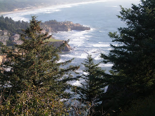
    These trees show the type of wind power on the high bluffs over the shoreline. The City water treatment plant is also Chetco Point Park
  • follow this trail up and across the bridge, hike out onto the farthest end of the rocky outcropping plateau during any storm. As you stand on the huge section of lava rock, the size of a football field, it shudders with each large wave as it thunders into the chasms far below. The violent waves of the Pacific Ocean are reclaiming the coast of Oregon, one bite at a time.

    This coastal storm pictured below, the result of a typhoon near Japan, is wailing on us right now in it's Oregon birthing pains. The motor home is rockin' and rollin'. Often, big shudders are shakin' our timbers. We never camped in the front line on the shore during anything like this before. The rain is horizontal and intermittant. The WX report indicates 50 mph winds at peak. We have experienced that before and still stayed on our wheels. Big trucks roll over at side winds above 60 mph. We have not tried that trick before.

    A big lake is forming then draining, in the beach parking lot in front of us. During heavy winter storms, the water is reported to be three feet deep across these RV parking sites. Many of the campers have already left and are still leaving early. Only the foolish ones like us, and the one visible in the camera (link below), are still here. The waves are getting bigger by the hour. The ocean is now a dark green-gray with the whitecaps starting to form much further out than before. Storm is hugging the coast from the south. Eerie sunlight pokes through from time to time.

    The waves had been only about 5 to 6 feet high in front of us, but now growing faster and moving faster. The large ones that break before shore, are following each other at much closer intervals. The U.S. Coast Guard station has the Harbor Bar warning lights flashing.

    The Coastie's have just returned from playing in the bigger waves offshore, on their 47 foot motor lifeboat
  • We had driven out onto the inner harbor river jetty, to look at the entrance... big waves in the entrance mouth with the inner harbor nice and calm. The winter swells raise and lower the floating docks on their big tidal guide pilings. In Newport Marina, I saw rub marks, ten feet above the normal on the tall pilings.

    We are parked in the front row of the camping line facing the Pacific Ocean about 25 yards in front of us. This is the camera link below. We are at the far end of the street in the lower left picture. Today the south camera is facing into the water sprayed wind, so pretty fuzzy images. The locals are driving down to park and watch this little storm build.

    The winter removal of the long aluminum beach ramps by motor crane, started as we were leaving. During winter storms, the swells and waves are over 3 feet above this pavement. On the port web cam link below, most times the roadway facing the beach, looks mellow with vehicles parked facing the seawall. The harbor looks calm and peaceful with people fishing from the high city pier visible at distance. The closer low dock is at the Coast Guard Station and sometimes has a resident sea Lion lounging on it.

    Port webcam
  • That white water in front of the seawall, 'was' the beach. Even with all it's bluster, this little storm is a wimp in comparison to the one we watched in 2003 early November.

    Taken through the coach window, Jetty straight ahead. The rain is hitting like bullets, the wind is getting much stronger and the entire rig is shuddering like it is in an earthquake. We may have a little damage from this 'blow' by the nights end. We just retracted the windward slide out room, after hearing sounds we never heard before. Did not want to do that because the added outboard weight was acting like a stabilizer. The 'landing gear' is all down now, just retracted the bedroom slide also. The table and computer is rocking like crazy, I am missing the keys while typing. Never been in a slightly used typhoon before. Japan had this storm before us. Can not see the waves now. They are really roaring. Really dark outside. WX radio just reported 15 to 17 foot (4.5 - 5.1 m) seas. We may go out to sea..... Hang on momma.....

    16 October, Starting our departure in morning, but we are now looking for a way out of here. California is reporting even more rain and some snow at the high elevations that we have to go over. Bicycle tour riders, take note. An earlier trip is advised for the future. This year's departure is over two weeks earlier than we ever did before and the weather is more winter-like than ever before. Each year it turns wintery earlier and earlier. AL Gore's Global Warming is sure strange. Maybe the Nobel Prize is a little premature... or far more than likely, highly Political? What do you think?

    Next post soon. Wireless was not available during some evening stops.
  • Wednesday, October 07, 2009

    Oregon Coast Motor Home Camping part 5

    posted from notes, much later than actual trip.
    Woke up to news of snow east of the Cascades in September. Earlier each year we travel now. Temperatures along the coast, have been in the 40's most nights now. Electic heater is a welcome little unit. As you progress along the coast, many scenic turnouts and hiking trails are easily taken advantage of. The high points offer sweeping vistas stretching for miles to the next horizon and out to sea. Located 12 miles (19.3km) north of gateway to the interior Florence
  • is Heceta Head lighthouse
  • 205 feet above the ocean. It's big beautiful, original, Fresnel First Order lens, and visited daily by tourists. Visible at 21 miles (34km), it is the brightest light on the Oregon Coast and open for limited tours daily.

    Winchester Bay Salmon Harbor
  • no utilities on the parking lot near restroom and showers, but $11 dollars is welcome for each night. Their many main campgrounds are various prices.

    Ungers Bay Fish and Chips
  • on pretty Cassie's little barge at T Dock, is great. Cassie Smith works from 11am to 8pm, fixing "the best fish on the bay". A romantic dinner cruise, surrounded by happy, contented wild ducks, without leaving smooth water.

    After setting up 'coach' for the stay, we Jeep back north to visit and shop at the small villages like Gardiner, stopping at other scenic stops and harbors along this coast. Do not miss experiencing the huge sand dunes along this 40 mile beach. Their dense Conifer forests growing out of the 6000 year old mountains of sand are amazing. This is an ATV/OHV paradise, rentals and motels cater to the 'sand runners'. Night camping with nearby facilities, on the park sand, just west of the marina, is free and very popular.

    Several other State Parks are available for camping as well. The still commissioned, Umpqua Lighthouse and State Park
  • with it's interesting history is a must see at the U.S. Coast Guard Station, especially at night. It's beautiful red and clear, first Order Fresnel, rotating lens is unique
  • It once floated on a basin of liquid mercury, driven by a wound clockwork mechanism, as were many rotating beacons of the past. View it in the predawn mist or late evening for the best effect of it's sweeping brilliant beam.

    The large fishing boats 'Grizzly' (at sea) and 'Ocian' ( to left), go to the waters of Alaska to fish. This peaceful harbor view is from our bedroom window. 'Valorous' is now being restored after 4 years of neglect, it's previous owner died in his sleep at 55. It's new owner is in the process of re-rigging her from a Bering Sea, Aleutians long liner, to a fishing rig using it's long outriggers. The crew from the Ali J is helping. Names like 'Dock Holiday', L Affair, Pier Pleasure, Div Ocean, Highland Fling, P&L Statement, adorn the craft in the harbor.

    Trip along the coast south to Coo's Bay
  • is again filled with scenic turnouts and hiking trails. North Bend is the site of The Conde McCullough Memorial Bridge
  • The entrance to Coo's Bay. Conde McCullough
  • was the master Engineer behind most of coastal highway 101's beautiful bridges built in the 1930's. The 'North Bend' of the Harbor is the location of The Old Mill Casino. Park overnight free and visit the casino or head out to Charleston, Empire and Cape Arago for sightseeing. Or park on the developed area with full hookups, and enjoy the harbor action. The dredges are working with the huge barges being filled. The tugs pull and push the loaded barge out to the ocean for off-loading and return. This is a continuous job with the task being repeated at approximately 3 year intervals for each harbor, all up and down the coast. DREDGING Hulu 40 min Modern Marvels


  • An afternoon seeing the Cape Arago and former site of Louis Simpson's Shoreline Estate and Shore Acres Gardens
  • The $3 dollar fee is well spent to visit the flower garden and scenic overlooks. Trails are abundant, as is the history of the former Oregon timber, shipping, and real estate father and son barons, as they developed this part of Oregon, creating thousands of jobs. The Simpson's lived in this 'garden House' while lumber from a shipwreck on the shoreline below, was salvaged to build a new home on this bluff, after the original was destroyed by fire.
    The lava fingers clawing their way to the surface from the ancient sandstone strata, is also captured in this closer image.

    Cape Arago with it's Lighthouse
  • (not accessable) rocky shoale, alive with many types of seals and seal lions is also a 'do not miss'. Artists and Photographers love this overlook. Winter storms as shown on the post cards, must be breath taking to watch. The storms even rise above the high bluffs towering over the shoreline, to decimate the forest at times.

    The beautiful, wild, scenic Oregon Coast is by Law, not allowed to be developed. Lawyers are endlessly trying every trick in their arsenal to circumvent this law. I Pray for their failure.

    At any given time, hundreds of bicyclists and motorcyclists from all over the world are on this scenic route, endlessly touring year around. Their rigs are little trailers to single units or packs of riders. Even the big 'Switzerland' truck and trailer rig headed to Alaska then down the coast all of the way to Patagonia. We often stay overnight at the same camp spots, catching them from day to day.

    The Coquille River lighthouse
  • decommissioned in 1939, replaced by more efficient navigation aids, then restored as an interpretive center in 1979, is 2 miles (3.2km) north of the litle scenic harbor village of Bandon
  • Bullards Beach State Park is nearby.

    Open to tour Cape Blanco Lighthouse
  • is the southernmost of the nine Oregon Lighthouses and it's state park is nearby.

    Port Orford
  • further south, is in a large natural bay, protected from the north storms. The views back toward the north, from the high mountain highway 101 turnouts are always worth stopping for.

    Humbug Mountain State Park
  • is another hidden jewel, a little further south, just under the highway 101 bridge. The shoreline access is good from this area. We have hiked this coastal beach on previous trips.

    Gold Beach
  • is the final resting place of the Mary D Hume

  • an over 100 year old ocean going ship with a colorful past, Deathlocked in a lawyers joy of litigation (lawyers got her money), now rotting into the shoreline near the small Rogue River Jet Boat tourist area, not far from where it was originally built. The little cafe at the farther end of the dock, had a great meatloaf lunch special for $6.95 on the day we stopped near the Mary Hume. Just north of Gold Beach, another Highway 101 bridge hides an old remnant of a ship hull partially embedded into the shore on the southwest side of the bridge. Look closely, it is hard to spot. Another 'lawyers' victim?

    Harris Beach State Park
  • with its scenic overlooks and beach access, is just north of Brookings. We have tried to get a campsite on the scenic front row, overlooking the Pacific Ocean. Good luck with trying to get reservations.
  • Oregon Coast Motor Home camping part 4

    Brighton Marina
  • is a choice crabbing site with RV overnight camping overlooking the peaceful little harbor inside the bay. Dozens of Gulls settle in for the night on the floating log breakwaters. They jockey for position using some system only understood by themselves. The owners of the marina will pull a Dungeness crab from their dock well, boil it and clean it for you for about 15 dollars. A dozen steamer clams will fill out the evening meal table to be enjoyed in the RV. All of this ambiance is overwhelming to a pair of desert rats like us.

    Drive back north to Cannon Beach
  • Mr Fulltano’s has the most spectacular Pizza we ever had anywhere. The Haystack, named after the countless huge rock monoliths off shore, is piled with all imaginable fresh vegetables until it is about 2 inches thick. The scenic little coastal villages like Manzanita
  • Nehalem Bay, State Park
  • and Wheeler
  • all worth the stop. Some are like postcards with colorful houses perched on hillsides. Most are only occupied during the warmer summer months. Wealthy absentee owners close them up the rest of the year. The coast of Oregon is for tourists or those able to afford the lifestyle. Attempting to move here and live this life with out having a healthy bank account is not recommended unless you are into poverty as a lifestyle.

    Moved south to Cape Lookout State Park
  • Drive back north to Tillamook Cheese factory
  • for a big ice cream serving, then south of town and nearby Air Museum in the original massive wooden hangar built for WWII blimps.

    This small plane apparently came to ground a little early, It was on the north side of the entrance road leading to the runway near the hanger. A row of trees separated it from the runway. Cut power a little early?

    Scenic drive around Cape Meares Lighthouse loop was another enjoyable side trip. This is the northern most of the Three Cape series loop.
    I Hiked down the paved trail to the Cape Meares lighthouse with it’s original First Order Fresnel lens
  • This beautiful piece of bullet shaped glasswork is over 6 feet tall and large enough to stand inside of. With the beam concentrated by multiple reflector surfaces, These engineering marvels were able to shoot a bright piercing beam of light for 21 miles to sea. Considering only kerosene and multiple wicks, using the 'center venting' principle in the Aladin Lamp, as the source of it's brilliant light, this is remarkable. Oregon Lighthouses


  • Originally most of these huge lenses were floated on a pool of mercury, driven by a weighted 'clock mechanism' and could be turned with one finger in spite of their massive weight. The mercury was removed and bearings now support these works of art. Nine operational lighthouses now exist along the scenic coast of Oregon, built to maintain an unbroken beacon system for Oregon coastal shipping. The 'Terrible Tillie' sitting on Tillamook Rock, an island far off the coast south of Seaside, is now a 'Columbarium' used to hold ashes of deceased.

    Back at Cape Lookout State Park and nightly walk, no nocturnal animals joined me. Cedar trees are about 8 feet wide at their many rooted base, giving them the local term of Octopus trees. Long beach walks to south end of ancient volcanic wall. Most of the Oregon coast is old lava flows from huge, ancient volcanoes far inland. Hiking trails are abundant in most of the State Parks. The Oregon scenic coastal trail system is designated as a bicycle route. Many international cyclers, loaded with camping gear, are on this route year around.


    Tuesday headed south along the coastal route toward the third Cape, Kiwanda, and Pacific City, picking up highway 101 once again.

    The Sea Hag in Depoe Bay is my cell phone stop for a call to an old friend Dave in ABQ. Watching the boats attempt to fight their way in and out of the ‘Worlds Smallest Harbor is always interesting and sometimes includes Whale Watching


  • These waves many times roar over the main street of Depoe Bay, to the delight of the tourists and locals alike. Always stop at the numerous scenic turnouts to view the waves. Names like ‘Devil’s and Boiler’ are used freely to describe these rocky outcroppings attracting the ferocious coastal storm activity. Even the mild weather is photo worthy with large driving waves. Storms such as we witnessed in our 2003 camping trip, are really fantastic.

    Stop in at the scenic point above Cape Foul Weather. This point high above the ocean records some of the highest winds along the coast. Nice little shop on the edge of the high bluff.

    Beverly Beach State Park
  • with it’s dense forest of trees, is under a big highway 101 bridge, 6 miles north of Newport. A Tsunami warning came while we were camped there overnight. The Indonesian earthquake raised the sea level about 3 inches at 1 am. Nothing to be concerned about because the quake was 4,800 miles away. In the mid 1960’s the Alaskan Quake claimed four lives at this campground with a Tsunami. After that experience the coastal warning system, with it’s sirens, came into effect.

    Wednesday brought us further south to Newport Oregon
  • Yaquina Bay. The Newport Marina was our campground for 3 nights. South Beach State Park Campground is also nearby but washing clothes was the priority and the marina has the newest facility. Fuel costs are dropping as oil falls again. A fill was good at $2.76 per US gallon (3.8L). Yaquina Bay Lighthouse
  • is on the north side of Yaquina Bay bridge and Yaquina Head Lighthouse
  • is 3 miles (5.4km) north of Newport. Both are easily accessable. Northernmost Yaquina Head is tourable most days.

    A trip upriver from the historic Newport bay front, brought us to Toledo
  • an old town with a logging connection from long ago, where my co-pilot bought some antique wares. Wood products are still in the process. The river is navigable for quite some distance. Large fishing boats are seen moored along the way, interspersed with old wooden pilings from a busy river system in the past. Barge and tug tows are common.

    The best seafood for the money, on the coast, is at the little Newport Café
  • on highway 101 in town, with dazzling Monique as our waitress. She and her husband own the little 24 hour cafe, open for just over a year. Her always friendly greetings and knack for remembering faces is refreshing. Monique has no tolerance for young teenage waitresses that roll their eyes when you ask them for a refill of soda. Monique’s clam chowder actually has clams in it, lot‘s of ‘em.

    Famous Mo’s has lots of potatoes like most clam chowder. The historic bay front with it's resident fishing fleet, is a don’t miss attraction. The harbor breakwater and the floating dock near the fish packing plant, is home to numerous Sea Lions. Their endless ‘barking’ is fun for us. It lulls us to sleep across the harbor where we are parked.

    The south jetty is sometimes accessible by 4 wheel drive. The south beach sand blows over it near the shore.


    Even in low wave conditions the importance of the Jetty is visible in these images. The crescendo of waves hitting the huge rocks is great to watch and photograph. The Pacific Ocean winter storms are a real treat..If you can stand up to the waves and spray. The locals view it as entertainment with no comparison.

    This beautiful Yaquina Bay Bridge designed in the 1930’s by Oregon’s Master Engineer Conde McCullough to replace the ferry system, is great at any time, including dusk, to photograph. We park so as to see it out our windshield. Night lighting is a red and green enhancement.


    The harbor just in front of our parking space, adds lots of various types of boats and action to the view. My nightly walks along the many docks, never fail to be interesting. Names like El Shaddai, Persistence, Kukana, Aqua Holic and many other creative logos adorn the boats.

    One electronically equipped, beautiful power boat, sank at the dock our last night here. The diver said the drain plug was in place, but the bilge pump design apparently allowed a reverse siphon action. Flying bridge top heavy, it turned upside down. Keith, other Port employees and a diver, worked to re-float it using many inner tubes placed internally, then inflating them.

    Keith, the local Salt, always has a story to tell. I met Keith years ago and continue to meet him each trip. His wife is from American Samoa (Tsunami just hit). He sailed his boat here long ago, took 45 days, bought her a pair of shoes, and still stays, living aboard at A dock, even buying a car. Kind of makes him a ‘lubber’ now doesn’t it? The Port Marina office ladies want to make a video starring Keith telling some of his sea stories. He now works at the Marina part time to pay his slip fee and get a little pocket cash. Nice little gig Keith, see you next trip.